Our Saturday Park Ride doesn't really need a map, but our four main routes when we're not in Richmond Park are:
WINDSOR
This is our flat-ish ride taking in the rolling roads around Chobham and then through Windsor Great Park, before a cake stop in Windsor. The return follows the River Thames for a flat and flowing run back towards Hampton Court.
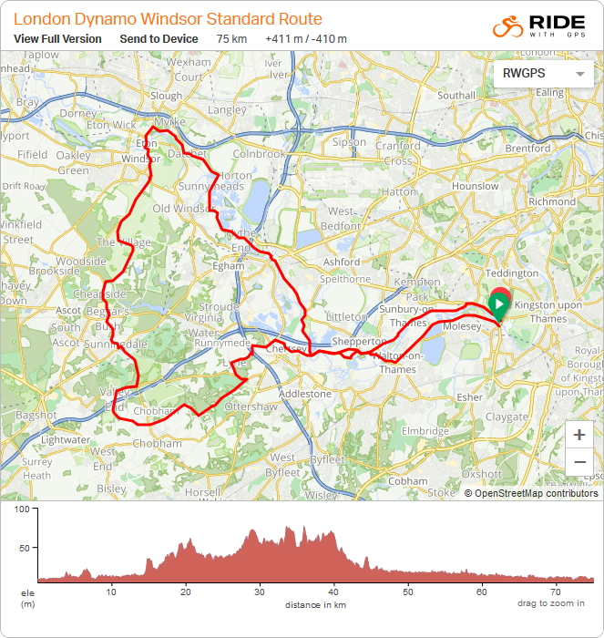
Click here to view the Windsor route on Ride with GPS
Distance : 75 kilometres / 44.5 miles
Elevation: 411 metres / 1348 feet elevation
WINDSOR
Alternate Route
This one is quieter, and a little lumpier. Following a similar route to our standard route on the way out. Returning from Windsor on the south side of the River Thames, heading over some rolling (and a little quieter) roads before rejoining the outbound route for a flat run home.
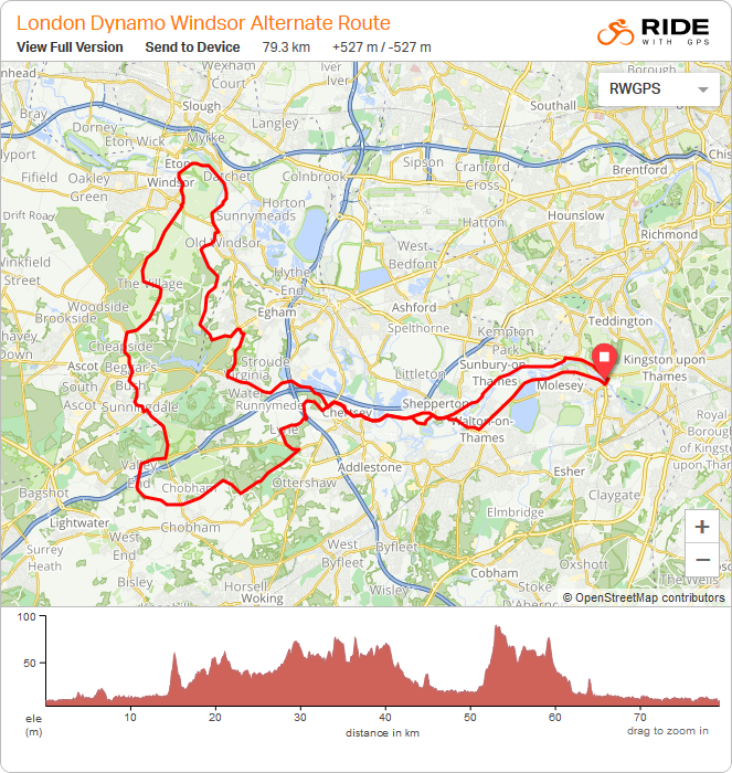
Click here to view the Windsor - Alternate route on Ride with GPS
Distance : 79.5 kilometres / 49.5 miles
Elevation: 527 metres / 1729 feet elevation
SURREY HILLS
Short Route
This is our 3 hills short ride, giving a flavour of the Surrey Hills. The route takes you up and along the northern ridge including a lovely run through Ranmore Common and a climb up the famous Box Hill for a cake stop.
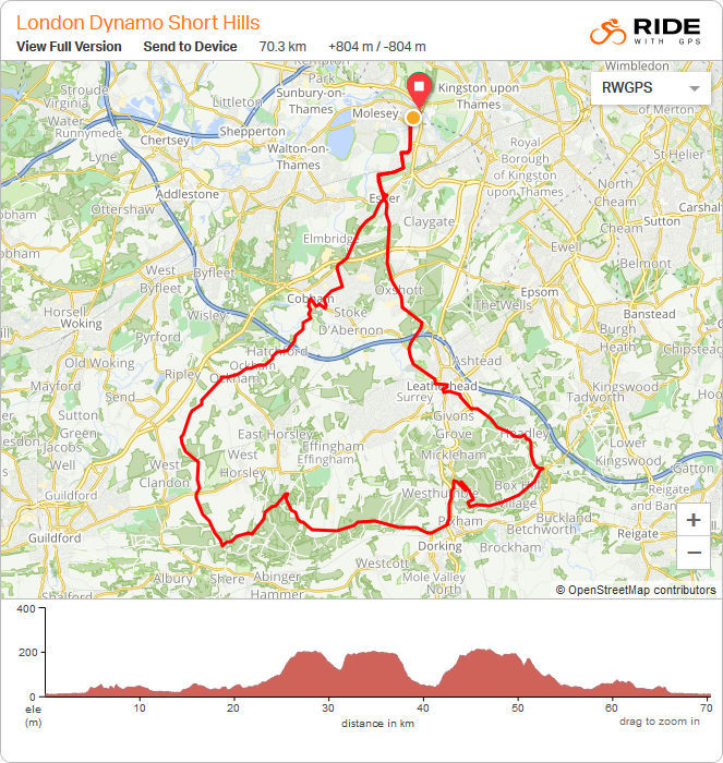
Click here to view the Surrey Hills Short route on Ride with GPS
Distance : 70.5 kilometres / 44 miles
Elevation: 804 metres / 2638 feet elevation
SURREY HILLS
Long Route
This is our 5 hills long ride, getting deeper in to what the Surrey Hills has to offer. Taking on the initially steep, then flowing pine tree covered climb up Holmbury Hill and on to Leith Hill; finishing with the zig zags of Box Hill and a cake stop.
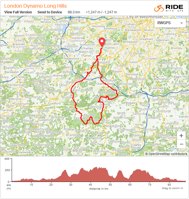
Click here to view the Surrey Hills Long route on Ride with GPS
Distance : 88.5 kilometres / 55 miles
Elevation: 1247 metres / 4091 feet elevation